Klik gambar untuk perbesar
Produk Digital
CAD-Earth
Belum ada ulasan ·
22 dilihat
Rp 77.500
Rp 350.000 -78%
PO 1 Hari Diproses penjual, dikirim maks 24 jam.
Pembayaran QRIS terverifikasi otomatis. Link download otomatis setelah lunas (email/WhatsApp).

Deskripsi
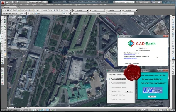
520 CAD-Earth v3.1.6 for AutoCAD 2013-2014 CAD-Earth is designed to easily import/export images, objects and terrain meshes between Google Earth and major CAD programs and create dynamic contour lines and profiles. Features: Import Google Earth image to CAD. Export CAD screenshot to Google Earth. Insert georeferenced images. Import Google Earth objects to CAD. Export CAD objects to Google Earth. Import Google Earth terrain. More than 3000 supported coordinate systems worldwide. Cross section from mesh. Profile from mesh. CAD-Earth for other AutoCAD versions can be downloaded from here . Google Earth plugin can be downloaded from there . What can we do with CAD-Earth :.
Ulasan Produk
- dari 0 ulasan
Masuk dan beli produk ini untuk memberi ulasan.
Belum ada ulasan. Jadilah yang pertama!