Klik gambar untuk perbesar
Produk Digital
RockWare GIS Link 2
Belum ada ulasan ·
15 dilihat
Rp 77.500
Rp 350.000 -78%
PO 1 Hari Diproses penjual, dikirim maks 24 jam.
Pembayaran QRIS terverifikasi otomatis. Link download otomatis setelah lunas (email/WhatsApp).

Deskripsi
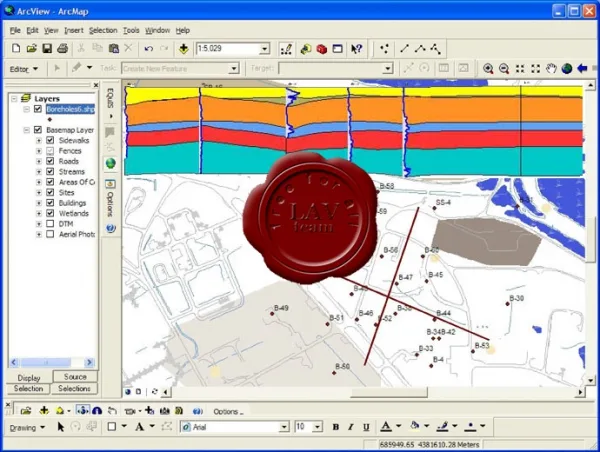
183 RockWare GIS Link 2 for ArcGIS v10 The new RockWare GIS Link 2 allows you to generate RockWorks cross-sections, profiles and fence diagrams using ArcMap and RockWorks15 . In Version 2 added striplogs, contour maps (ground surface and structural elevations), and isopach maps. Features: Import your RockWorks borehole locations as a layer in an ArcMap geodatabase. The RockWare GIS Link 2 toolbar in ArcMap. The RockWare GIS Link toolbar installs into ArcMap. Create Profiles and Sections using the RockWorks engine and any of the following data types: Logs only, Lithology, Stratigraphy, Interval(I)-Data, Point(P)-Data, Time(T)-Data, Aquifer Data, and Fracture Data. Point Snapping Tool allows you to snap to the closest borehole or well location when choosing your Section Lines. Create 3D Fence Diagrams using the RockWorks engine and any of the following datasets: Lithology, Stratigraphy, I-
Ulasan Produk
- dari 0 ulasan
Masuk dan beli produk ini untuk memberi ulasan.
Belum ada ulasan. Jadilah yang pertama!