Klik gambar untuk perbesar
Produk Digital
S.S. Papadopulos & Associates GroundWater Desktop
Belum ada ulasan ·
6 dilihat
Rp 77.500
Rp 350.000 -78%
PO 1 Hari Diproses penjual, dikirim maks 24 jam.
Pembayaran QRIS terverifikasi otomatis. Link download otomatis setelah lunas (email/WhatsApp).

Deskripsi
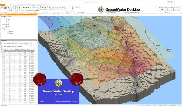
GroundWater Desktop is a 3D Windows application aimed at groundwater modelers, environmental engineers and hydrogeologists. It allows you to visualize and analyze both geological/hydrogeological data (eg water levels, pollutant concentrations, well lithology) and the results of flow and transport models. The application supports working interactions with models such as MODFLOW, MT3D, MODPATH, as well as unstructured mesh versions (MODFLOW-USG), etc. You can view models and outputs using techniques such as slices, cut-aways, layer “exploded” views - this allows you to better understand the three-dimensional structure of groundwater and contaminants. Geospatial data is supported: import of rasters, shapefiles, orthophotos, the ability to overlay buildings and other objects. Built-in.
Ulasan Produk
- dari 0 ulasan
Masuk dan beli produk ini untuk memberi ulasan.
Belum ada ulasan. Jadilah yang pertama!