Klik gambar untuk perbesar
Produk Digital
Topodrone TOPOSETTER & TOPOSETTER P4RTK
Belum ada ulasan ·
12 dilihat
Rp 77.500
Rp 350.000 -78%
PO 1 Hari Diproses penjual, dikirim maks 24 jam.
Pembayaran QRIS terverifikasi otomatis. Link download otomatis setelah lunas (email/WhatsApp).

Deskripsi
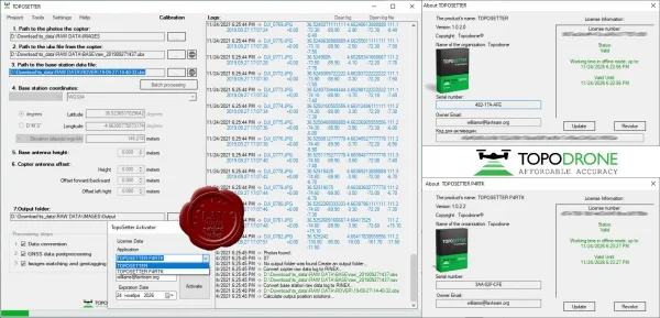
862 Topodrone TOPOSETTER v1.0.2.0 & TOPOSETTER P4RTK v1.0.2.2 TOPOSETTER is a simple but powerful tool for automatic post-processing of GNSS measurements in any coordinate system and replacing navigation coordinates in EXIF image tags with high-precision coordinates obtained after post-processing of GNSS data, ensuring a high level of accuracy of output materials. TOPOSETTER has additional automation capabilities that significantly reduce the amount of manual labor and save the time allocated for preparing data for further photogrammetric processing: Processing GNSS measurements in any coordinate systems Loading coordinate systems from a PRJ file Post-processing of GNSS data Additional settings for GNSS measurements Converting GNSS data from UBX format to RINEX Setting up XYZ antenna offset Correction of antenna tilt based on drone IMU data Calculation function calibrated.
Ulasan Produk
- dari 0 ulasan
Masuk dan beli produk ini untuk memberi ulasan.
Belum ada ulasan. Jadilah yang pertama!